Public Notice
The Mayor and Town Council of the Town of Chincoteague voted to approve the new FEMA flood maps and flood study which went into effect on May 18, 2014. A Council Workshop was held on Thursday March 19, 2015 at 5:00 p.m. during which public comment was received and Council later approved amendments to the Town Flood Ordinance, including a 2 foot freeboard requirement for new or substantially improved structures, at the regular Town Council meeting on April 6, 2015. Public notice is provided on the following matter:
Floodplain Ordinance– Amend Town Code – Chapter 30 Floods with changes including but not limited to adoption of revised Flood Insurance Rate Maps and the Flood Insurance Study report for the Town of Chincoteague (Community ID number 510002) which will become effective as of May 18, 2015. Existing floodplain management regulations which meet the standards of Paragraph 60.3(e) of the NFIP will be updated to incorporate guidance from the Virginia NFIP Coordinator.
For additional information, and to review a copy of the revised documents, please contact Kenny Lewis, Building and Zoning Administrator at (757) 336-6519, or FEMA Region III National Flood Insurance Program, 615 Chestnut Street, 6th Floor, Philadelphia, PA 19106-4404 at (215) 931-5512 or www.fema.gov.
What is Freeboard?
One of the recent changes to the Town Floodplain Ordinance is a requirement for ‘freeboard’. This building standard will only apply to new construction or substantially improved structures as an added measure of safety from flood risk. To learn more see the FEMA brochure here, and ask about it at the Town Office.
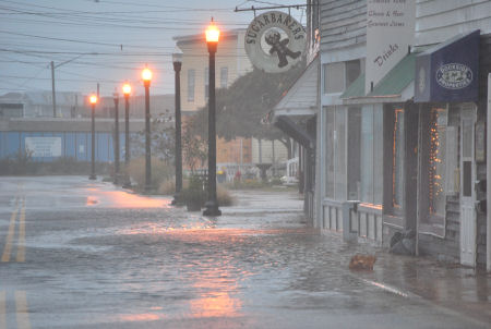
Do you know your flood risk?
If you live, work or own property in the Town of Chincoteague, you should learn more about your flood risk and review our updated coastal FEMA flood maps.
Flood protection information is available at the Town of Chincoteague offices, 6150 Community Drive, and on the Town website: www.chincoteague-va.gov, or call (757) 336-6519. Click here to learn more or visit www.floodsmart.gov .
Flood Insurance Rate Maps indicate flood-prone coastal areas in Accomack County, and insurance companies use these maps to determine flood insurance rates. Accomack County and the Town of Chincoteague are required to adopt updated maps to continue participating in the National Flood Insurance Program (NFIP), which makes flood insurance available to the community.
As a result of these map updates, some buildings in the Town of Chincoteague may, for the first time, be excluded from the flood zone, known as the Special Flood Hazard Area, or SFHA. This may result in those affected property owners no longer being required to purchase flood insurance. Other areas will see a reduction in the regulatory base flood elevation (BFE) that will affect building requirements and possibly future insurance rates.
To view your property and determine your flood risk based on the new flood insurance rate map information, visit: http://accomack.mapsdirect.net/Account/Logon
Additional information and assistance is available at the Town Office, and in the brochures below:
Flood Insurance Study – Accomack County
Map showing properties proposed outside of flood zone (green area)